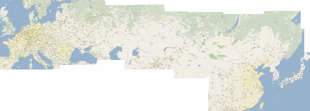
This is quite cool – just going through some old files and I found this map from my travels back in 2010. It’s a map of the route I took to get from York in the UK to Beijing near the Chinese coast – entirely by train.
The map is an enormous PNG file. I travelled with no technology (how much things have changed now!) and used an A4 folder to carry all of my information with me. The map is nothing more sophisticated than lots of screen grabs of Google Maps stitched together, then I drew the route on the resulting image in Paint. The red line shows the route. Red dots are stopping stations. Black dots are where I changed trains. The map may not look flashy, but it served its purpose, and it showed the route clearly when printed at 300dpi.
The entire journey took about three weeks including around 7 days of sight-seeing along the way. The bulk of the journey mileage was handled by the Trans-Mongolian train, which is a 6-night direct service between Moscow and Beijing. Travelling through Europe was done with a combination of day and night trains. The Man in Seat 61 provides an excellent introduction to the different ways to get to Moscow from the UK – I chose the slightly awkward route via St Petersburg to avoid needing an expensive Belarusian visa.
We normally think of the world as a very big place, where the only way to travel long distance is by air. There is something very humbling about going by train though, to think that there are two strips of carefully engineered steel running almost continuously half way around the world. To see every town along the way, see the timezones, climates, geography and flora changing along the way, really gives a sense of scale of the world that can’t be felt when travelling by plane.
Here is the map. To see the full-size version, it’s best to open it on your computer. Right-click here, and choose ‘save image as’. (Note it’s a 10MB image if you’re on a slow connection!)

