Since my post last year on modelling cities in Grasshopper, I have learnt a few more things in how to get the most out of Grasshopper. I am now much more adept in using meshes, a much lighter data type than surfaces, and I have learnt a few more tricks in getting the buildings to look a little more building-like.
The combination of these means that I can now load in much larger areas into Grasshopper with much better performance. I decided to revisit the challenge of opening cities in Grasshopper and see where I could take it.
The city of York
In this post, I have modelled my historic home city of York. It is famous for its Minster and for its City Walls, and also has two rivers, numerous parks, and other historical buildings, which should make for some interesting renders.
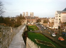
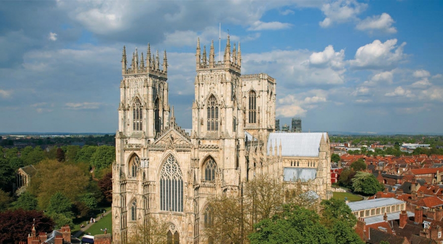
Here is an actual photo of York:
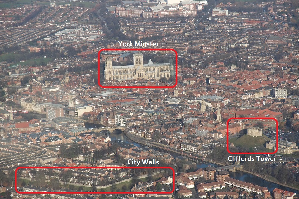
Image Wikipedia
And here is a rather awesome video of York:
Modelling in Grasshopper
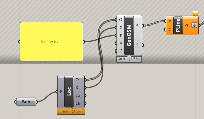
As in my previous attempts, I am using OpenStreetMap map data. I download a map on the OSM export page, which provides an OSM file. I then use the Elk plugin for Grasshopper.
I have set up a standard Grasshopper file where I can connect it to any OSM file, and with no user intervention, it will generate a 3D model of the map data in this OSM file. The Grasshopper file is available here.
Results
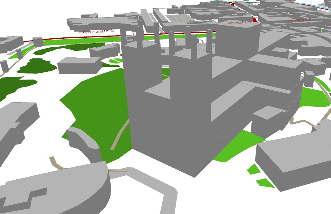
Here is the above photo modelled in Grasshopper:
The buildings are mostly modelled using their outlines, which are available for most city centre locations and key landmarks. A very few buildings also have building height data, which allows the Minster to be modelled well. All buildings without height data are instead modelled by a random height of between 5 and 15 metres. (This gives a slightly more realistic appearance than, say, having all buildings to be 10m tall.)
York Minster
York Minster is a highly impressive structure, towering over the rest of the city.
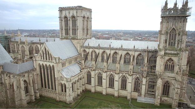
Somebody has spent a lot of time and effort not only entering the height and outline of the Minster into the OSM database, but recording the heights and outlines of all the individual elements of the building. This means that we get a surprisingly intricate model of the Minster out of the box with no user intervention.
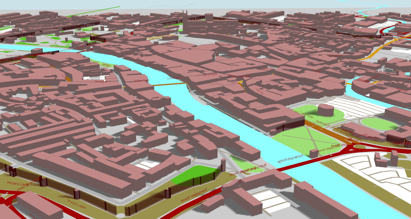
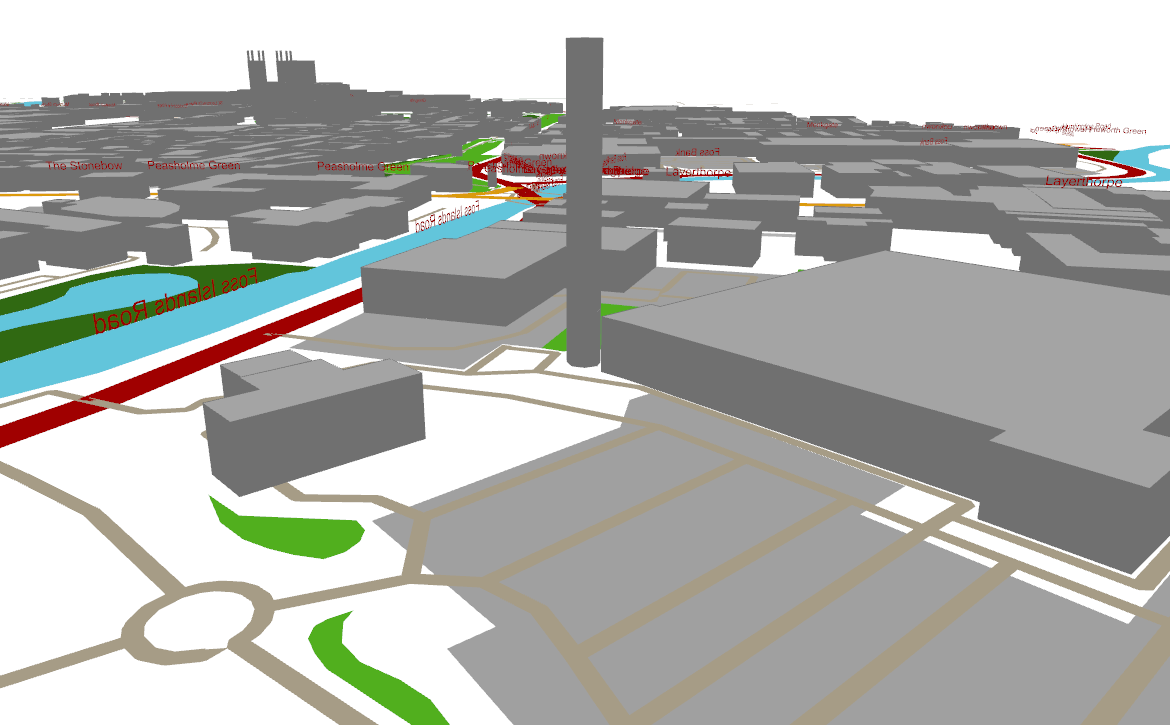
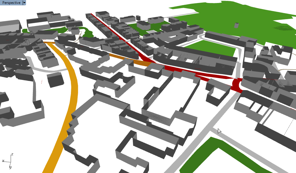
Foss Islands Road
Foss islands is an old industrial area near the city centre which is now mostly devoted to retail. A key landmark remains – an ominous Victorian chimney which stands slightly out of place next to a Morrisons supermarket.
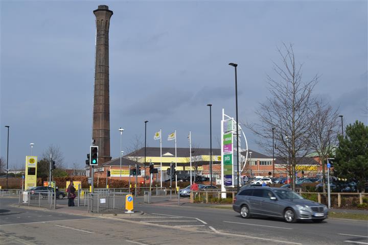
Image source
This also has height data, which produces some interesting views in its location next to the River Foss:
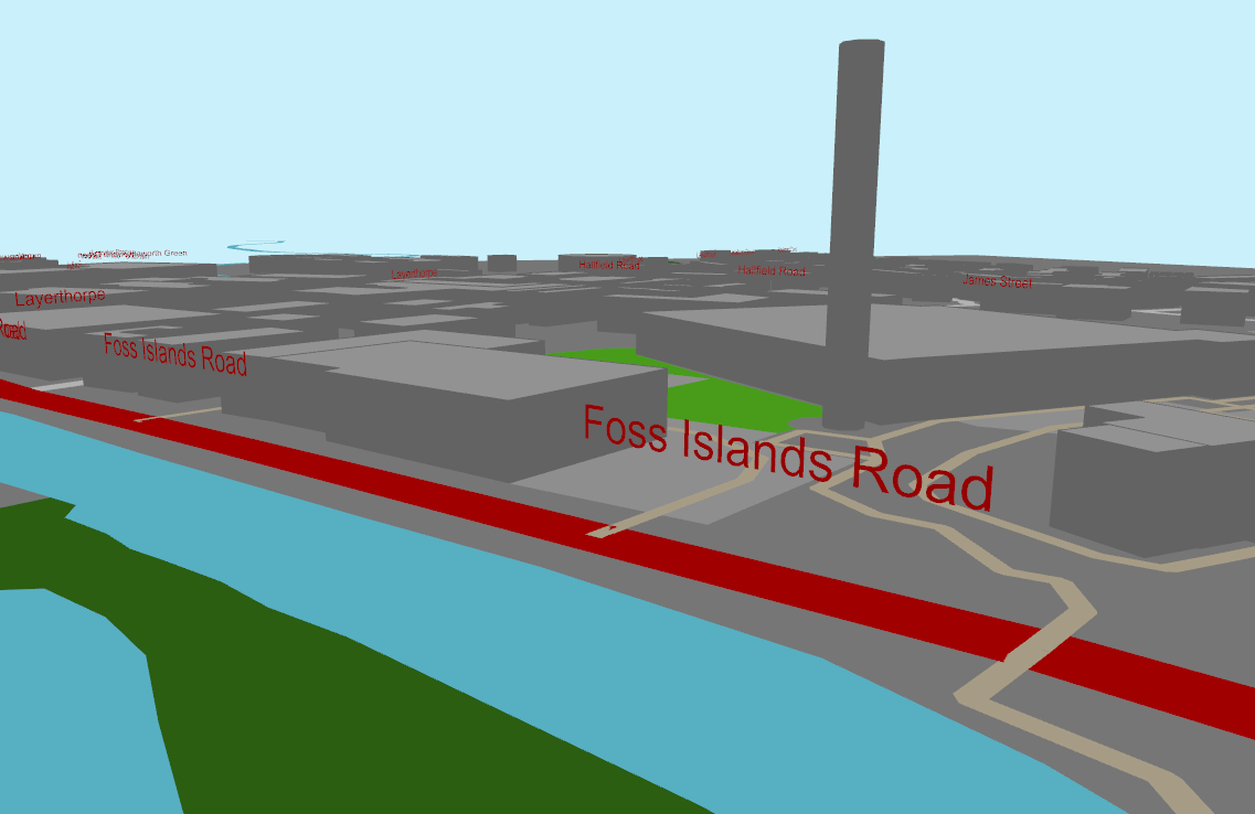
Looking the other way, we can see the Minster in the distance:
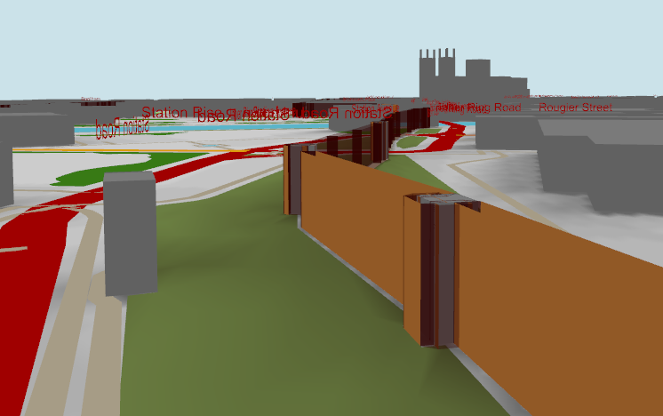
York city walls
The city walls, around 800 years old, almost entirely circumnavigate the city centre.
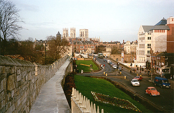
Image by Steve Nova: source
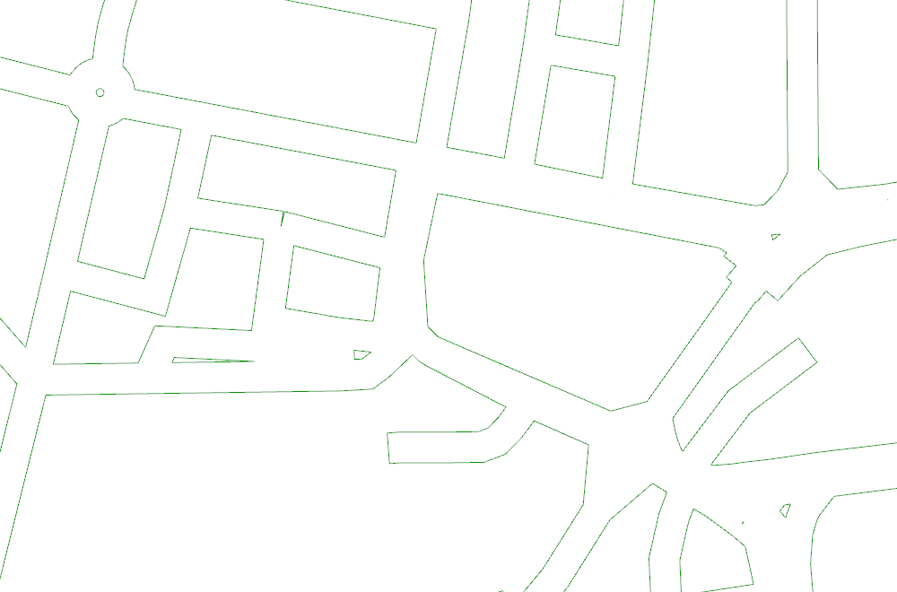
Unfortunately there is no automatic way to model the grass banks around the walls, but the walls are saved as polylines in OSM. These walls are made by converting the polylines into 2D meshes (the same as how the roads are generated) and then extruded 10m up. They are quite jagged though and could do with some more work.
C# code and links
Some key code snippets used:
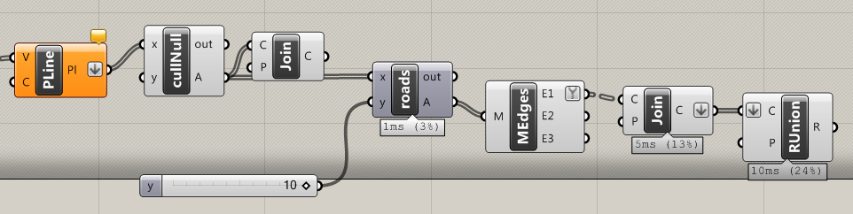
Roads
OSM roads are effectively polylines. In order to render them with colours, they need ‘expanding’ into 2D shapes that have a width. This is done by creating a mesh face for every polyline segment. The component for this is available here.
Buildings
Here is a more in-depth discussion on how to create buildings in 3D using OpenStreetMap data.
Grasshopper file
The whole Grasshopper file is available here.